 |
| Found on the highway, full intact, rigged, and ready to fish. Tried using it once, to no avail. |
 |
| Provo |

 |
| What a spot for a snack and a stretch |
 |
| Ryan |
 |
| Never a good sight for a cyclist, was still happy to see though. Fortunately a calm day as I passed through the canyon. |

 |
| Hundreds of thousands of years of evolutionary history |

 |
| Sun's not down and temperature's dropping in a hurry |


 |
| You know it's f*ing cold out, when the olive oil clouds |
 |
| Surprisingly, I only had a couple comments on this - computer malfunctions sometimes, must switch to km's momentarily |


 |
| Donald's riding from Denver to Las Vegas. His rear derailleur is stuck in first gear with a screwdriver, and he has no front derailleur. He's also carrying all of his stuff on the front of his bike, as well as on his back. |


 |
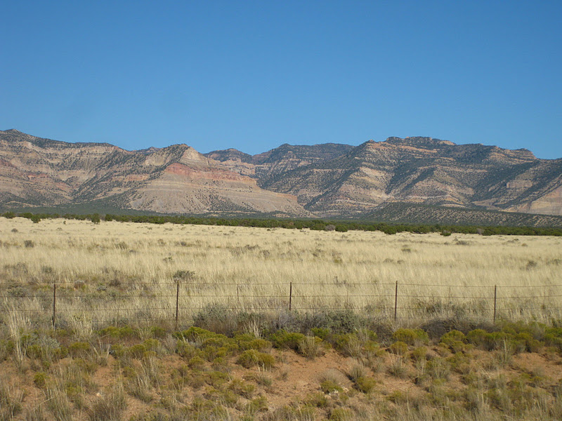
| Welcome to the desert |


 |
| Camping on the open range |


 |
| The area around Moab is strikingly beautiful |
 |
| Fun bike path into town. |

 |
| Moab |
 |
| Moab from above |
 |
| Quick check of the slickrock - awesome. |


 |
| Hiking up Mill Creek |

 |
| My own pool, perfect on a hot day |
 |
| Frisbee, Moab-style |

 |
| Our camp on the bluff |

 |
| Darryl, Cory, Shawn, Jodi, and Peter |


 |
| The slickrock is actually quite sticky for bikes. The name comes from early settlers in the area who rode horses on the rock, and noticed the metal shoes wouldn't grip. |


 |
| The slickrock trail is marked with white paint, and traverses about 10 miles, almost entirely on rock. |


 |
| Moab and the Colorado flowing through |
 |
| It was incredible getting up hills like this, standing up on the bike, the rear tire would grip the whole time. |

 |
| Jodi |


 |
| Arches |


 |
| Mike |
 |
| Fun climbing |
 |
| Soooo windy |
 |
| Foolhardy |
 |
| Double-O |
 |
| The "primitive" trail back to the car |


 |
| Kevin's diesel van |


 |
| The Kamloops crew |
 |
| James and Jordan, warming up |
 |
| Petroglyphs |

 |
| The UMTRA project |
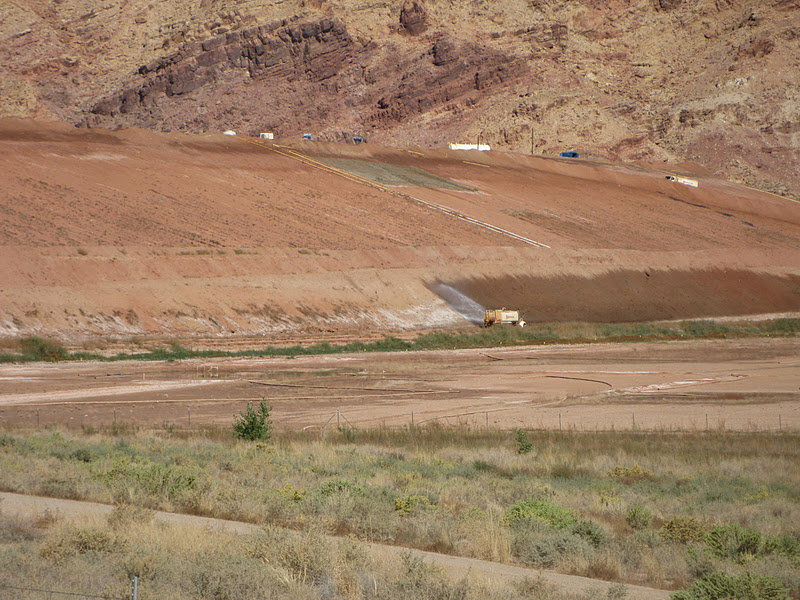 |
| Uranium mill tailings = major cleanup operation = expensive |
 |
| Radioactive |

 |
| They built a whole new rail line to transport the uranium tailings to the dump site |


 |
| The tailings site was setup by a company called Atlas (that's now bankrupt). The site is conveniently located directly next to the Colorado river, and just a few miles from the town of Moab. |

 |
| Farms in Souther California are fed by water from the Colorado |
 |
| Biking back to camp from town |

 |
| BBQ'n |
 |
| Fire with tumbleweeds |
 |
| Fire with gas |
 |
| Goodtimes |
 |
| Passing the bottle around |
 |
| Eric, mid-yawn |
 |
| Bye Moab, I'll miss you |


 |
| Strange, large, insect I've never seen before |
 |
| The area around southern Utah is like a super-highway for airline traffic. I counted ten jets in the air at one point. |

 |
| Comb Ridge |

 |
| Cliff dwellings, thousands of years old |

 |
| Bob, Jim, and David |
 |
| Well worth the detour |

 |
| Always a great view after a long climb |


 |
| Moki Dugway |

 |
| Goosenecks. I met Lucy and Dave here, a nice, traveling, Australian couple, that provided some delicous instant, vietnamese coffee, and some other great food items. |

 |
| Mexican hat, what the nearby town was named after, supposed to look like an upside down sombrero |

 |
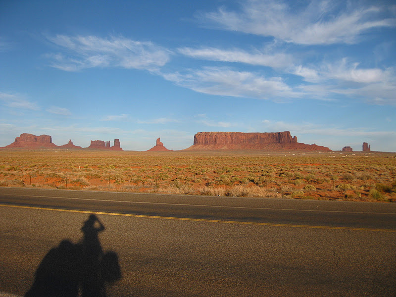
| Look familiar? Where Forrest Gump ended his run |


 |
| Monument Valley |


 |
| With so many "no trespassing" signs, and loads of fencing. I had to ask these people to camp on their land, and Darlene kindly let me stay the night. |


 |
| Mike introduced me to a Navajo burger. I was battling a terrible headwind, light rain, struggling up a hill to look over and see him wave me over, and offer to buy me dinner. Thanks so much! I saw him the following morning when he pulled over and gave me his continental breakfast. |
 |
| Cold night camping at marsh pass, and snow on the mountains across the valley |
 |
| Highest yet |


 |
| Another cold morning |
 |
| The cheap of the cheap |
 |
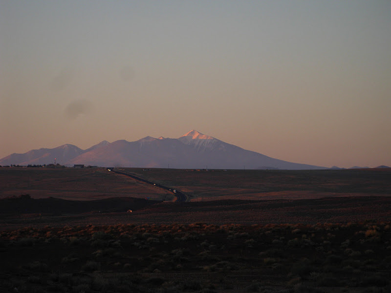
| Looking at hill ahead to get to Flag |


Wow! That looks gorgeous!
ReplyDeleteYea definitely one of my favorite areas on the trip so far. The brilliantly, vibrant, red rock is so awesome... not to mention the people - incredible.
ReplyDelete